EnviSAT Links
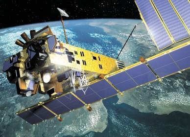 | 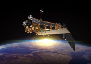 |
| photo | photo |
| Configuration | Launch | Mass | Average Power (W, sunlight/eclipse) |
|---|---|---|---|
| Launch configuration: | Launch Site: Kourou (Latitude 5°3') | Service Module 2673 kg | Payload 1841/1886 |
| length 10.5 m | Launch Vehicle: Ariane 5G | Payload Equipment Bay 1021 kg | Payload Module 860/527 |
| envelope diameter 4.57m | Perigee: 783 km (486 mi) | Payload Carrier 2078 kg | Service Module 859/684 |
| Apogee: 785 km (487 mi) | Fuel 319 kg | Total Load 3560/3097 | |
| In-Orbit configuration: | Inclination: 98.60 deg | Payload Instruments 2118 kg | System Capability 3847/3291 |
| 26m X 10m X 5m | Period: 100.50 min | Total 8211 kg |
Instruments
| Instrument | Function | |
|---|---|---|
| ASAR | An Advanced Synthetic Aperture Radar (ASAR), operating at C-band, ASAR ensures continuity with the image mode (SAR) and the wave mode of the ERS-1/2 AMI. | 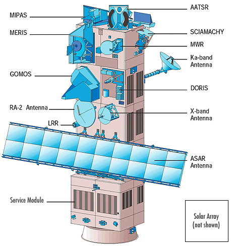 Link |
| MERIS | MERIS is a programmable, medium-spectral resolution, imaging spectrometer operating in the solar reflective spectral range. Fifteen spectral bands can be selected by ground command, each of which has a programmable width and a programmable location in the 390 nm to 1040 nm spectral range. | |
| AATSR | The prime scientific objective of the Advanced Along Track Scanning Radiometer (AATSR) is to establish continuity of the ATSR-1 and ATSR-2 data sets of precise sea surface temperature (SST), thereby ensuring the production of a unique 10 year near-continuous data set at the levels of accuracy required (0.3 K or better) for climate research and for the community of operational as well as scientific users who have been developed through the ERS-1 and ERS-2 missions. | |
| RA-2 | Radar Altimeter 2 (RA-2) is an instrument for determining the two-way delay of the radar echo from the Earth's surface to a very high precision: less than a nanosecond. It also measures the power and the shape of the reflected radar pulses. | |
| MWR | The main objective of the microwave radiometer (MWR) is the measurement of the integrated atmospheric water vapour column and cloud liquid water content, as correction terms for the radar altimeter signal. In addition, MWR measurement data are useful for the determination of surface emissivity and soil moisture over land, for surface energy budget investigations to support atmospheric studies, and for ice characterization. | |
| GOMOS | GOMOS measures atmospheric constituents by spectral analysis of the spectral bands between 250 nm to 675 nm, 756 nm to 773 nm, and 926 nm to 952 nm. Additionally, two photometers operate in two spectral channels; between 470 nm to 520 nm and 650 nm to 700 nm, respectively. | |
| MIPAS | The Michelson Interferometer for Passive Atmospheric Sounding (MIPAS) is a Fourier transform spectrometer for the measurement of high-resolution gaseous emission spectra at the Earth's limb. It operates in the near to mid infrared where many of the atmospheric trace-gases playing a major role in atmospheric chemistry have important emission features. | |
| SCIAMACHY | SCIAMACHY is an imaging spectrometer whose primary mission objective is to perform global measurements of trace gases in the troposphere and in the stratosphere. | |
| DORIS | The Doppler Orbitography and Radio-positioning Integrated by Satellite instrument is a microwave tracking system that can be utilized to determine the precise location of the ENVISAT satellite. | |
| LRR | The LRR is a passive device which is used as a reflector by ground-based SLR stations using high-power pulsed lasers. In the case of Envisat, tracking using the LRR is principally accomplished by the International Laser Ranging Service (ILRS). |
Background