|
|
 |
| News: 2006 |
|
|
3 October 2006
- On 26 September 2006, the CloudSat
spacecraft entered a safe mode known as Sun
Acquire. In sun acquire mode, the spacecraft and
the radar are safe but the radar is not
operating. The spacecraft was successfully
returned to Earth-pointing mode on 28 September,
and the radar was re-activated on 3 October
2006.
17 August 2006
- CloudSat continues to operate and collect
data without incident.
- At the request of the Science Team, the
project implemented a slight off-nadir pointing
of the CPR (0.16° along-track in the
forward-looking direction) at 20:16:46 UTC on 15
August 2006 in order to reduce ground clutter in
the CPR data.
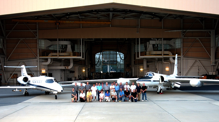
- The CALIPSO-CloudSat Validation Experiment
(CC-VEx) was conducted over the southeastern
United States and adjacent waters from 26 July
to 14 August 2006. Two aircraft were based at
Robins AFB in middle Georgia (shown above): the
NASA ER-2, carrying a cloud radar (CRS), lidar
(CPL), and MODIS simulator (MAS), and the WMI
Learjet, which carried various cloud probes for
in-situ sampling. A third aircraft, the NASA
King Air B200, carrying a high spectral
resolution lidar (HSRL), was based at NASA
Langley Research Center in Virginia. A total of
12 flights were conducted under CloudSat/CALIPSO
satellite overpasses, including 4 night flights,
observing a variety of thin and thick cirrus,
mid-level clouds, precipitating clouds, and
aerosols. (Photo: Raymond Crayton/Robins AFB)
3 August 2006
Click the
image for a larger version
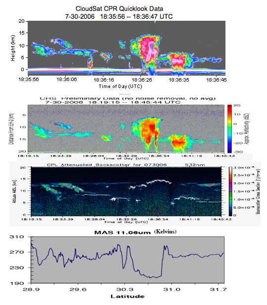
- The CALIPSO-CloudSat Validation Experiment
(CC-VEx) is well underway. On 30 July, the NASA
Dryden ER-2 (airborne radar, lidar and MODIS
simulator) and the WMI Learjet (in situ
measurements) conducted comparison flights with
the Cloudsat and CALIPSO (CC) satellite missions
along a track extending off the coast of the
southeastern US. The mission was noteworthy for
observing a wide spectrum of cloud and aerosol
features. The validation experiment continues
until 14 August.
[CloudSat radar imagery courtesy of the
CloudSat team. Cloud Radar System (CRS) courtesy
of G. Heymsfield (NASA GSFC). Cloud Profiling
Lidar (CPL) measurements courtesy of M. McGill
(NASA GSFC) and MODIS Airborne Simulator (MAS)
observations courtesy of J. Meyers/R. Dominguez
(NASA ARC).]
- A routine CPR calibration was performed on 2
August over the Indian Ocean by slewing the
spacecraft off-nadir and observing the ocean at
an incidence angle of 10°. Information gathered
from this operation will be used to fine-tune he
parameters used in the Level-1B processing
activities.
Click on the
image to pop up a new window, showing the MODIS
image and the CloudSat profile.
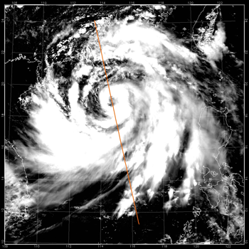
- At approximately 0553 UTC (1:53 am EDT) on 2
August 2006, CloudSat flew over the eye of
Typhoon Prapiroon as it approached southern
China. (Click the image for a larger image with
the CloudSat radar cross-sectional view along
the ge line.)
The upper image is from the MODIS instrument
on the NASA Aqua satellite, to an idea of how
the storm looked from the top. The bottom image
is from NASA's new CloudSat satellite. The
CloudSat radar flies in an on-orbit formation
with the Aqua satellite, approximately one
minute behind, as part of the A-Train
constellation of satellites.
(Image: NASA/JPL/The Cooperative Institute
for in the Atmosphere (CIRA), Colorado State
University)
27 July 2006
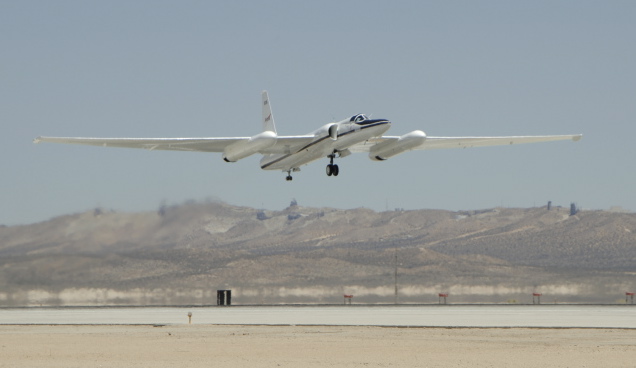
The CALIPSO-CloudSat Validation Experiment
began this week, based at AFB in Warner Robins,
GA. Primary aircraft for CloudSat validation
include NASA ER-2 (shown above departing Edwards
AFB), carrying cloud radar, lidar, a MODIS
simulator, and the WMI Learjet, carrying cloud
probes for in-situ sampling. The experiment will
run through mid-August. (Photo: Tony
Landis/NASA)
- The CloudSat Data Processing Center (DPC) at
CIRA continues to post Level data to the
quicklook data site. Level 1 and Level 2 data
products are going through checkout and will be
released to the science community soon.
- On Thursday, 20 July 2006, CloudSat had a
successful Post Launch Review (PLAR).
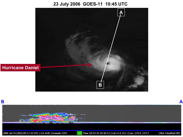
Click on the
image for a PDF mosiac version
Hurricane Daniel intensified between 18 and
23 July in the central Pacific Ocean east of
Hawaii. NASA's new CloudSat satellite was able
to capture and confirm this transformation as
seen in this series of side-view images. (Click
the mage above for the multi-image PDF file.)
The top images (from GOES-11) give idea of how
the storm looked from the top. The bottom images
are CloudSat profiles. From one side of the
storm to the other, on 18 July, Daniel to be
approximately 700 km. The scale from top to
bottom is approximately 30 , so the clouds in
this hurricane reach heights of about 20 km. On
19 July, Daniel appears to intensify and became
more compact as its maximum sustained winds
ncreased from 75 to 90 mph. By 23 July, the
winds had intensified to greater than 100 mph.
(Images: NASA/JPL/The Cooperative Institute for
Research in the sphere (CIRA), Colorado State
University/NOAA)
20 July 2006
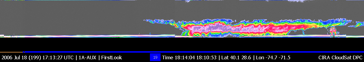
Click on the
image for a larger version
This side-view image of Tropical Storm Beryl
(SE of the North Carolina t) was taken from
NASA's CloudSat satellite on 18 July at
approximately 2:10 PM EDT (1810 UTC). Notice
that the solid line along the bottom of the
panel, is the ocean surface, disappears in
center of the storm, an area of intense
cipitation. It is likely that the precipitation
rate in that area exceeds 30 hr (1.18
inches/hour), based on previous studies. From
one side of the storm the other, Beryl appears
to be approximately 800 km (497 miles). The
scale top to bottom is approximately 30 km (18
miles), so the clouds in this storm reach
heights exceeding 15 km (9 miles). (Images:
NASA/JPL/The ve Institute for Research in the
Atmosphere (CIRA), Colorado State University)
13 July 2006
- The 3-second offset of CPR data vs. the
digital topographic database was used by
incorrectly applying an offset between the CPR
M1 mirror reference and the alignment cube
reference frame. Two tables were uploaded to the
aft to resolve this problem.
- CloudSat successfully performed its DMU
maneuver on 12 July at 07:44:43 , as planned.
The nominal target delta-v was 3.7 cm/s and the
achieved delta-v as 3.9 cm/s, for a 5.4%
overburn. This execution error is within the
allowable tolerance. After the maneuver,
CloudSat was moving towards CALIPSO at tely 1
km/day. We are currently estimating the next
formation flying e maneuver will occur on or
around 28 July, assuming the atmospheric density
ues stay reasonably close to what they are now.
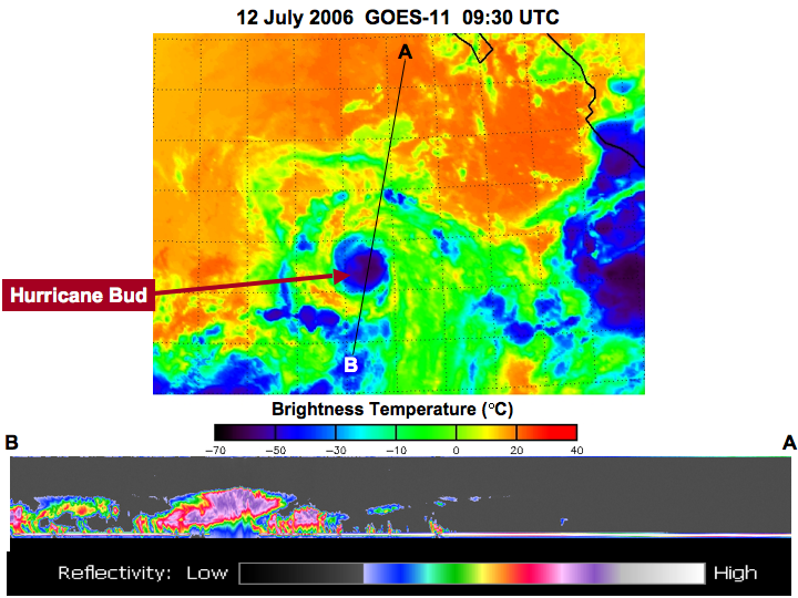 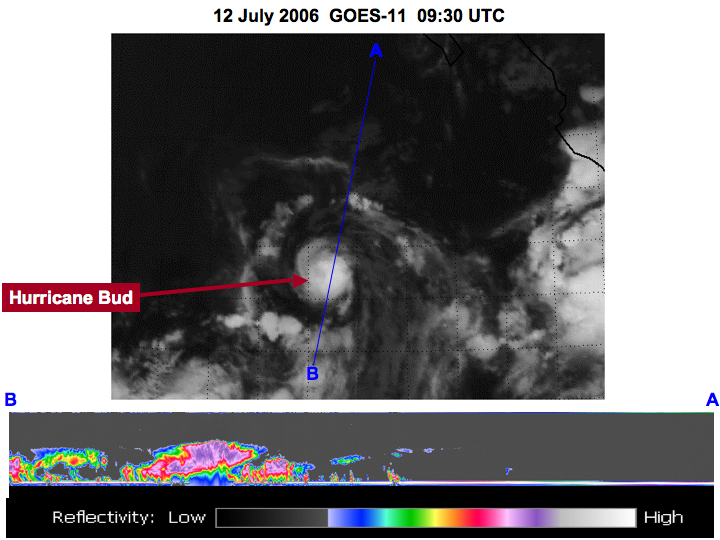
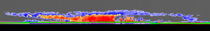
Click either
image for enlarged versions
CloudSat passed over Hurricane Bud in the
Pacific Ocean southwest of at approximately 2:30
AM PDT (0930 UTC) on 12 July 2006. The ground
track of loudSat's radar is shown as the A-B
line in the GOES-11 images above (click for
larger versions). While the GOES-11 image shows
a large horizontal area, at's radar provides
information about the vertical distribution of
clouds and ecipitation along the ground track,
as shown in the lower images. The scale in the
radar images from left to right (B to A) is
about 1300 km (808 miles), and he vertical scale
is 30 km (18.6 miles). Colors in the radar
images indicate e strength of the scattered
radar energy, termed the reflectivity. Cloudsat
w very nearly over the center of the hurricane,
but at this early stage of the torm the eye is
very small and not well developed. (Images:
NASA/JPL/The ative Institute for Research in the
Atmosphere (CIRA), Colorado State /NOAA)
22 June 2006
- The CloudSat radar experienced a 7-minute
timeout after a body current occured on Friday
afternoon (16 June). This resulted in a 7-minute
data gap ound 2048 UTC on 16 June. The 7-minute
timeout -- a change in radar mode from
perational to receive-only -- is a
pre-programmed response to a body current p
event. After 7 minutes, the radar returned to
operational mode and is ming nominally.
- The University of Wyoming airborne cloud
radar flew under a CloudSat ss in Northern
California on 16 June. The next underflight
opportunity is on e 23rd, followed by the final
opportunity on the 30th.
- As of 21 June, 2006 the RSC has captured
99.93% of the data taken by the cloud radar and
the CloudSat Data Processing Center has ingested
and processed % of that data through Level 1.
15 June 2006
-
At approximately 1000 UTC on 14 June 2006,
CloudSat entered its "control box" with respect
to CALIPSO. This means that CloudSat's
groundtrack is within 1 km of CALIPSO's lidar
groundtrack and is maintaining an along-track
separation approximately 10 to 15 seconds before
CALIPSO. Today (15 June), CloudSat successfully
executed a small orbit-lowering maneuver of
about 5.5 cm/sec to settle into this position
and stop CloudSat's drift relative to CALIPSO.
This was executed so accurately that the next
adjustment would be in August. However, there is
a current plan by CALIPSO to maneuver in July,
and if that takes place, we will need to
maneuver then.
-
CloudSat tracked across tropical storm
Alberto as it spun over the Gulf of Mexico the
morning of 12 June 2006 as reported on NASA's
Planetary Photojournal. This image
comparison shows how CloudSat "sees" such storms
differently than conventional weather
satellites. The CloudSat image is compared with
images obtained at nearly the same time from two
National Oceanic and Atmospheric Administration
National Weather Service tools that are
mainstays for monitoring the development and
movement of tropical cyclones: the NEXRAD storm
detection radar, which maps out precipitation
patterns for that portion of the storm that
comes into its range, and the GOES-12
(Geostationary Operational Environmental
Satellite) infrared imager. CloudSat sees the
storm outside the range of NEXRAD and provides
significantly greater vertical detail compared
to the GOES satellite. NEXRAD, for example, can
only see out to about 402 kilometers (250
miles), and so could not see the portion of the
storm that CloudSat was flying over at the time.
GOES-12 only sees the very top of the clouds,
and cannot provide any detail about what is
being seen beneath the cloud tops.
The CloudSat data show a storm that reaches
about 16 kilometers (10 miles) in height and
extends perhaps 1,000 kilometers (621 miles) in
scale. The green line at the bottom of the
CloudSat image is the radar echo of the Earth's
surface. Where this line starts to disappear
(change color) under the storm is where the
rainfall is heaviest. Very heavy rainfall can be
seen over about 400 kilometers (249 miles) of
the satellite track. Cirrus clouds can also been
seen out ahead of the storm (near letter A) --
this is also evident in the GOES-12 image. A
smaller thunderstorm is visible in the CloudSat
image under that cirrus cloud cover near the
letter A. That storm is completely hidden from
view in the GOES infrared image.
- The Wyoming Cloud Radar flew a track under
the CloudSat overpass on 2 June near Mt. Lassen,
California and another on 7 June off the coast
of California in a marine stratus layer. This is
a cloud type that is known to challenge the
radar sensitivity, and we will be studying the
results closely.
6 June 2006
- All radar and spacecraft systems continue to
perform nominally.
- A radar calibration maneuver was performed
today over the Indian Ocean. Prior to the
maneuver, the radar was commanded from transmit
to receive-only. The maneuver was successfully
completed, and the radar was returned to
transmit mode.
- To find out where CloudSat is and where it
will be for the next 16 days, check out this website.
The tools on this website were developed by
Louis Nguyen at the Langley Research Center.
2 June 2006
- CloudSat transitioned to its operational
mode when the Cloud Profiling Radar (CPR) was
activated around 1443 UTC on Friday, 2 June
2006. The CPR is operating normally. Data is
being flowed from the RSC in Albuquerque to CIRA
at Colorado State University. Quicklook data
products are being created approximately 1 hour
after download. CloudSat's measurement mission
is underway!
- The Wyoming Cloud Radar flew a track under
the CloudSat overpass near Mt. Lassen, CA on 2
June.
- Trim Burn No. 2 was executed early this
morning (2 June). This 5 cm/sec burn refined our
frozen orbit parameters and imparted a slow
drift back toward CALIPSO.
- Near-term maneuver milestones
TM3 (Trim Burn No. 3), 15 Jun 06
1 June 2006
- With the successful completion of OR2 (orbit
raise maneuver no. 2 - segments A & B) on 27
May, the CloudSat spacecraft is now part
of the A-Train Constellation. Delta-V
magnitudes (and execution errors) for segment A
& B were 1.396 m/s (0.11% under burn) and
1.276 m/s (1.0% under burn), respectively. Up to
this point in time only 5.6 kg of approximately
76 kg of hydrazine propellant has been used.
Remaining maneuvers are for minor adjustments
only (i.e. trim burns).
- The inclination trim burn performed on 28
May was successful, with a -3.47% error. The
drift rate with respect to Aqua and CALIPSO is
so low that the TM1 manuever (29 May) is no
longer necessary.
- On 30 May, it was decided that it was not
necessary to make a Nodal Shift adjustment. We
are slowly drifting back into our "operational
box" that would establish us formation flying
with CALIPSO. We will await the results of the
CALIPSO maneuver on 31 May to determine when the
next adjustment will be made (ie TM2).
- CALIPSO joined the A-Train on 31 May.
CloudSat plans to make an in- orbit trim
adjustment once CALIPSO's location is
established.
- Activation of CloudSat's Cloud Profiling
Radar is now planned for Friday, 2 June 2006.
Check-out periods for the various CloudSat data
products will begin soon after transition to
operate mode.
- Near-term maneuver milestones
- TM2 (Trim Burn No. 2), 03 Jun 06
- TM3 (Trim Burn No. 3), 09 Jun 06
25 May 2006
- The 94-GHz Cloud Profiling Radar (CPR) of
the CloudSat Mission was successfully
transitioned to Operate Mode on 20 May. It was a
perfect beginning because every engineering
parameter being monitored reached the predicted
range of values. More importantly, CPR was
measuring clouds and precipitation within
minutes afterwards. More quicklook images can be
found at the CloudSat Data Processing Center web
site [link to www.cloudsat.cira.colostate.edu]
at the Cooperative Institute for Research in the
Atmosphere (CIRA) of Colorado State University.
CPR was in the Operate Mode continuously for
about 4 hours.
- The two nodal shift burns were successfully
completed on 22 and 23 May 2006. [Note: Nodal
shift burns are required to ensure that CloudSat
and CALIPSO will overfly the same point on the
ground even though they will be spatially and
temporally separated in the A-Train
Constellation.] The planned delta-V for the two
burns achieved execution errors of 4.97% and
0.43% (under burn), which is well below the
requirement of 10%.
- Orbital raise maneuver number 1 (segments A
& B) was completed on 25 May. Later analysis
of the maneuver indicated that the performance
of segments A and B were within 0.19% and 0.49%.
- Near-term maneuver milestones [Note: the
trim burn schedule is subject to change]
- OR2A & OR2B (Orbit Raise Maneuver No. 2,
Segments A & B), 27 May 06
- TM1 (Trim Burn No. 1), 29 May 06
- Tno (Nodal Shift Trim Burn), 02 Jun 06
- Tinc (Inclination Change Trim Burn), 02 Jun
06
- TM2 (Trim Burn No. 2), 03 Jun 06
- TM3 (Trim Burn No. 3), 09 Jun 06
20 May 2006
- After determining an orbital segment well
away from known radio astronomy sites and having
favorable coverage for ground control,
CloudSat's Cloud Profiling Radar was activated
for about four hours on Saturday, 20 May for a
brief test. Immediately after activation, the
satellite passed over a small squall line in the
North Atlantic, providing the first image of
clouds for the CloudSat mission. (Click here for a larger image showing
the orbital track or here for a high-resolution
image.) The radar was switched back to
receive-only mode at the end of this test and
will remain in this mode until CloudSat is
established in the A-Train formation at the end
of the month.
- The radar activation allowed us to perform
an end-to-end test of the flight and ground
system. Cloud data acquired by the CPR was
downlinked to the RSC in Albuquerque,
transferred to CIRA in Fort Collins, and
processed through Level 1B. Quick-look images
were available in less than one hour from data
downlink.
- The image above is the first 126 seconds
(~800 km along-track) of data from the CloudSat
Cloud Profiling Radar, which was activated for a
total of approximately 3 hours and 45 minutes.
This section of data was taken over the North
Atlantic approaching Greenland. It shows a
frontal system with convection complete with
bright band under cirrus overcast -- something
passive sensors would never see. It is
precipitating and we guess that it is light
precipitation. The rest of the data are equally
stunning, showing shallow clouds, ITCZ
convection, polar storms, and too much good
stuff to mention (in the words of our PI).
- The radar was returned to receive-only mode
(sigh...). Permanent radar activation will not
occur before 31 May.
18 May 2006
- The Closed-Loop Calibration burn was
successfully completed on 12 May.
- The Open-Loop Calibration Burn was
successfully completed on 13 May. The
performance error was -9.7% vs. a 12% acceptable
error. This is a significant milestone, in that
we have completed all spacecraft commissioning
activities leading to the first nodal shift burn
(scheduled for 22 May).
- CPR electronics were activated on 15 May.
The telemetry values compare well with those
obtained in thermal vacuum tests at the
spacecraft facility.
- The CPR mirror was successfully rotated to
the HPA "B" side on 16 May.
- Two practice turns over the North and South
poles (simulating cross track burns) were
performed in the blind on the night of 16 May.
Data at the RSC indicated the turns were
successful. BATC engineers are still evaluating
the data.
- Near-term milestones
Maneuvers
- - Dno1 (Nodal Shift Burn 1), 22 May
- - Dno2 (Nodal Shift Burn 2), 23 May
- - Orbit Raise #1, 25 May
- - Orbit Raise #2, 27 May
CPR (Cloud Profiling Radar Instrument)
- - CPR Operate Mode (4 hours only), 20 May
11 May 2006
- The CloudSat spacecraft remains healthy and
safe.
- Several spacecraft practice rotations
(attitude maneuvers) were successfully
performed. These rotations demonstrated the
ability to rotate the spacecraft from instrument
nadir-pointing to different attitudes that
aligned the thrusters along desired delta V
vector directions (and back again to nadir).
- The attitude error threshold and persistence
limits were changed from 6° and 30 seconds to
30° and 60 seconds. The new limits are still
adequate to ensure spacecraft safety, but lessen
the probability of a premature fault trip during
rotations or transitions from sun acquire to
point state.
- The control frame for point-standby state
was changed from science to body frame to help
ensure that the star tracker fields-of-view are
not obstructed by the sun or Earth.
- Near term milestones
Maneuvers
- - CLC (Closed-Loop Calibration Burn), 12 May
06
- - OLC (Open-Loop Calibration Burn), 13 May
06
- - Dno1 (Nodal Shift Burn 1), 22 May 06
- - Dno2 (Modal Shift Burn 2), 23 May 06
CPR (Cloud Profiling Radar) Instrument
- Electronics Turn On, 15 May 06
- M6 Mirror from Stowed to Operational
Position, 16 May 06
- Transition to Receive Mode, 20 May 06
4 May 2006
- All passes with the Air Force Satellite
Control Network (AFSCN) continue normally.
- Two rotations of the spacecraft were
successfully performed on 4 May. These rotations
demonstrated the ability to rotate the
spacecraft from nadir pointing to an attitude
that aligns the thrusters along the
minus-velocity vector (and back again to nadir).
These rotations are to be used during the
checkout burn and the closed-loop burn,
scheduled for next week.
- Coarse sun sensor readings and a higher than
expected Earth albedo level (that caused false
sun presence indications on one or more sun
sensors) were affecting the ability of the
spacecraft to fully transition from 'sun
acquire' to 'point' state. Spacecraft engineers
downloaded the data and determined that the some
of the limits needed to be widened for the
transition to be successful. It was determined
that the proposed change of limits would pose no
risk to the spacecraft. New table uploads were
accomplished that modify the attitude limits and
lengthen the time for the activity. On 3 May,
the spacecraft maneuver-to-point was successful;
the radar is nadir-pointed.
- Further activities during CloudSat's first
week on orbit included a propulsion system
pressure check (with latch valves open),
indicating that there are no thruster valve
leaks, and several flight software table
uploads, which were successfully accomplished.
29 April 2006
- All planned CloudSat spacecraft activities
up to this point in time have been successfully
completed including activation of GPS (Global
Positioning System) receiver no. 1. The flight
system remains healthy and safe.
28 April 2006
27 April 2006
- Following a thorough data analysis,
engineers and mission managers concluded the
unusual temperature sensor readings observed on
the Delta II's second stage during the previous
two launch attempts were primarily the result of
higher temperature pressurization rates and are
not indicative of any defect in the sensor
itself. They concluded the sensor does not
require replacement and can fly as is, allowing
a launch attempt on Friday morning (28 April).
Weather is not expected to be a concern for
Friday morning's launch.
- Thursday morning's planned launch of NASA's
CloudSat and CALIPSO satellites from Vandenberg
Air Force Base, Calif., has been postponed at
least 24 hours, to no earlier than Friday
morning, April 28, at 3:02 a.m. PDT. Engineers
and mission managers are assessing a suspect
temperature sensor on the Boeing Delta II
rocket's second stage that may require
replacement.
26 April 2006
- The launch of NASA's CloudSat and CALIPSO
satellites from Vandenberg Air Force Base,
Calif., was scrubbed this morning at 1:24 a.m.
PDT due to thick clouds. Launch has been
rescheduled for Thursday, 27 April, at 3:02:37
a.m. PDT.
25 April 2006
- NASA's CloudSat and CALIPSO (Cloud-Aerosol
Lidar and Infrared Pathfinder Satellite
Observations) launch from Vandenberg Air Force
Base, Calif., was scrubbed this morning shortly
before 3 a.m. PDT due to higher than allowable
upper level wind conditions. The next launch
attempt is tentatively set for Wednesday, 26
April, at 3:02 a.m. PDT, pending availability of
all required Western Test Range assets.
23 April 2006
- This morning's launch of NASA's CloudSat and
CALIPSO (Cloud-Aerosol Lidar and Infrared
Pathfinder Satellite Observations) from
Vandenberg Air Force Base, Calif., has been
postponed. The refueling aircraft required to
maintain the radar tracking plane was
unavailable to support a launch attempt today
(Sunday). Mission managers are reviewing the
next available launch opportunity.
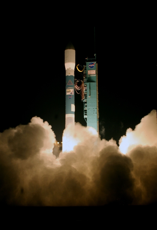
- The photo below shows CloudSat and CALIPSO
on the Delta II last night (Saturday night)
before this morning's launch attempt.
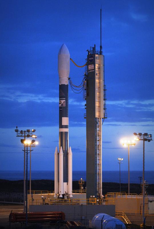
The CALIPSO and CloudSat
satellites are set to launch at 3:02 a.m. PDT,
Sunday April 23rd from Vandenberg Air Force Base
(VAFB) on missions to study clouds and aerosols,
tiny particles in the air. CALIPSO and CloudSat
are set to fly into orbit aboard a Boeing Delta
II rocket. The Delta II is designed to boost
medium- sized satellites and robotic explorers
into space. NASA selected a model 7420-10C for
this mission, which is a two-stage rocket
equipped with four strap-on motors and a
protective 10-foot payload fairing. (Photo
Credit: NASA/Bill Ingalls)
21 April 2006
- Today's launch was scrubbed at T-48 seconds
due to loss of the primary and backup phone
communications between the Mission Directors
Center at Vandenberg and the Centre National
d'Etudes Spatiales (CNES) Space Command in
Toulouse, France. The communications loss is
being evaluated.
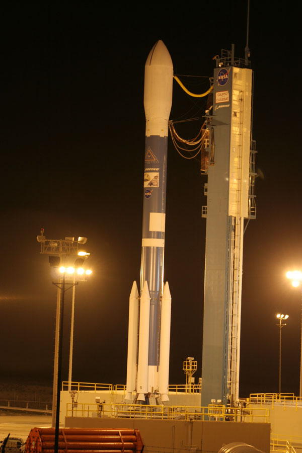
- The photo below shows the tower rollback
last night before the launch attempt this
morning. (Click for a larger version.)
19 April 2006
- Workers at Space Launch Complex 2 fueled the
Delta II second stage Tuesday (18 April) for
flight with storable hypergolic propellants.
Officials also conducted a launch countdown
dress rehearsal.
- No significant issues or concerns were found
during the Flight Readiness Review on Monday (17
April). Technicians installed the payload
fairing around the two spacecraft on April 14
and are conducting a routine state-of-health
check today.
- Plans call for the RP-1 fuel, highly refined
kerosene, to be loaded on the rocket's first
stage on Thursday afternoon. Early that evening,
the mobile service tower will be retracted from
around the rocket. Liquid oxygen will be loaded
into the first stage during the terminal
countdown sequence that starts at 4 a.m. EDT
Friday. There is currently an 80 percent chance
of acceptable weather conditions for launch.
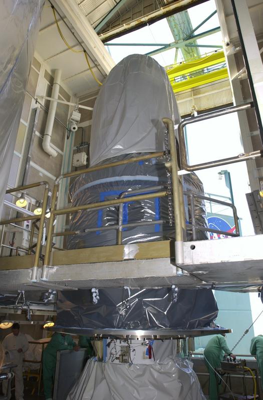
14 April 2006
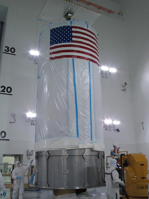
- CloudSat/CALIPSO were encapsulated inside
the payload fairing on Friday, 14 April 2006.
The photos below show the stacked spacecraft
atop the Delta II before the installation of the
payload fairing and partway through the process.
The third photo shows a closer view of the
CALIPSO spacecraft atop the DPAF containing
CloudSat. (click for larger versions, opens in
new window.)
12 April 2006
- The Flight Program Verification, an
integrated electrical and mechanical flight test
involving the Delta II and the CALIPSO/CloudSat
payload, was successfully completed on
Wednesday, 12 April 2006. Following the test,
technicians began installation of the launch
vehicle ordnance.
- CloudSat
Media Day at Colorado State University was
held on Tuesday, 11 April in Fort Collins.
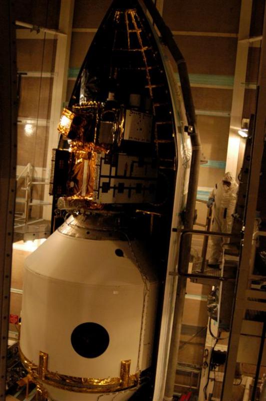
9 April 2006
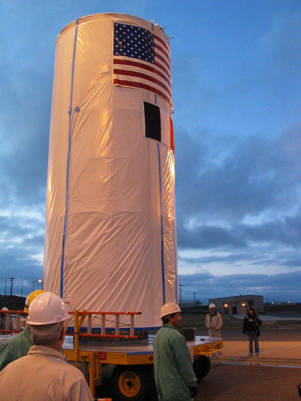
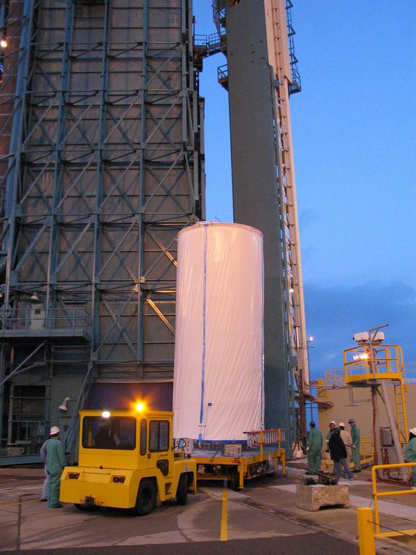
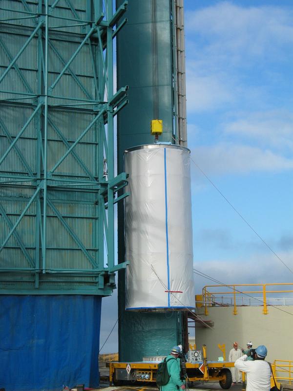
- The CloudSat and CALIPSO spacecraft were
installed into the environmentally controlled
payload transportation canister on 7 April and
successfully moved to the launch pad and mated
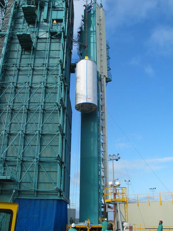
to the Delta II launch vehicle on 8 April 2006.
The photos below show the "canning" process at
the Astrotech facility, the move to the launch
pad, and the hoisting onto the launch vehicle.
(click for larger version, opens in new window.)
6 April 2006
- NASA successfully completed a flight
simulation of the Delta II rocket on 4 April at
Space Launch Complex 2 at Vandenberg AFB.
- The Delta Mission Readiness Briefing held at
NASA HQ was successfully completed.
- CloudSat spacecraft battery reconditioning
was successfully completed on 1 April.
30 March 2006
- CloudSat GPMC was successfully held on
Monday 27 March.
- The nine-day spacecraft battery
reconditioning began on Saturday, 25 March.
23 March 2006
- Kennedy Space Center notified the CloudSat
Project that the Western Range has approved the
20 April 2006 CloudSat-CALIPSO launch date. Our
first launch attempt is therefore scheduled for
3:01 AM PDT (1001 UTC) on 20 April 2006.
- Launch vehicle FTS batteries were activated
on 19 March 2006. The batteries have a 45-day
"wet life".
- The Delta-GPMC has been rescheduled to 27
March 2006.
16 March 2006
- Boeing submitted the Green Sheet to the
Range requesting a 20 April 2006 launch date.
- CloudSat staff is preparing for the Delta
GPMC which is scheduled for 28 March 2006 to
support the new proposed Launch Readiness Date.
2 March 2006
- CloudSat prepared and submitted to Boeing
the input for the next contingency detailed
launch trajectory analysis (DTO). The launch
period for this analysis is 16 May to 16 June
2006. This contingency DTO is required due to
the changing solar geometry as we approach the
summer solstice. Boeing will analyze and provide
the final DTO in 6 weeks.
23 February 2006
- CloudSat Management, NASA Headquarters,
CALIPSO, and Boeing attended a launch
schedule-planning meeting at KSC last week. All
participants reached a tentative launch schedule
for an early April launch date.
- A Mission Operations Working Group meeting
was hosted by CIRA in Fort Collins last week.
Team members from RSC, BATC, and JPL were in
attendance. The CIRA team presented a detailed
explanation of the workings of the data
processing center, including a demonstration of
data following through the various processing
systems, and a series of discussions were held
on data delivery and timing issues.
16 February 2006
- The TWP-ICE field campaign in Darwin,
Australia was successfully completed. The JPL
Airborne Cloud Radar was deployed on 14 flights
for a total of 58 hours of flight time,
including flights during overpasses of the Aqua,
Aura and Terra spacecraft. The data accumulated
over the nearly 4-week campaign will be used to
refine and improve CloudSat data product
algorithms.
9 February 2006
- CloudSat prepared and submitted to Boeing
the input for the next detailed launch
trajectory analysis (DTO). The launch period for
this analysis is 15 April to 15 May 2006. This
new DTO is required due to the changing solar
geometry as we approach the summer solstice.
Boeing will analyze and provide the final DTO in
6 weeks.
2 February 2006
- Boeing machinists in three states voted
Wednesday to ratify a new contract and end a
walkout of about 1,500 workers that began in
November. The machinists will return to work on
Monday.
26 January 2006
- All spacecraft launch processing activities
remain on hold as the Boeing labor union strike
enters its thirteenth week.
- The 94 GHz Airborne Cloud Radar is
performing well during the TWP-ICE field
campaign in Darwin, Australia. Three successful
flights on the Twin Otter were conducted thus
far.
- Project staff from JPL, Ball and USAF/Det12
attended a 4 day refresher course on the
CloudSat instrument and spacecraft at Kirtland
AFB.
19 January 2006
- All spacecraft launch processing activities
remain on hold as the Boeing labor union strike
enters its twelfth week.
6 January 2006
- CALIPSO and CloudSat are installed in the
Dual Payload Attach Fitting at the Astrotech
payload processing facilities on north
Vandenberg. They will remain there until a
launch date is determined and then be prepared
for transportation to NASA's Space Launch
Complex 2. Further Delta II preparations at the
launch pad are on hold until the
CALIPSO/CloudSat payloads arrive for
installation atop the second stage.
| |