 |
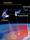
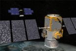
CloudSat.jpg
(think Weather
Channel radar maps), CloudSat can take three-dimension al profiles
of the atmosphere, measuring how clouds, aerosol particles and
precipitation are distributed vertically. This atmospheric data has
lots of scientific uses , which is why scientists are pretty excited
about the new satellite . But the goods that CloudSat will deliver
also sound like exactly what
256 x 253 |
10.90kB
source page
|
 |
cloudsat poster .jpg
Cloudsat is a
space mission to study clouds, taking 3-D images of them using
advanced radar technology. It was launched April 28, 2006. Cloudsat
is orbiting Earth, flying in formation with
263 x 200 | 13.30kB
source page
|
 |
CloudSat Auto0. jpeg
230 kg, 270 W
Table 1: CPR instrument parameters Figure 4: Simplified block
diagram of CPR Validation of the data products will use remote
sensing measurements from surface and airborne platforms together
with in-situ aircraft
524 x 519 |
38.60kB
source page
|
 |
cloudsat-050405 -browse.jpg
NASA's
CloudSat Spacecraft Arrives at Launch Site A NASA spacecraft
designed to reveal the inner secrets of Earth's clouds has arrived
at Vandenberg Air Force Base, Calif., to begin final
1067 x 800 | 145.90kB
source page
|
 |
133371main clou dsat362
250.jpg
Images/animatio n above : CloudSat science animation:
CloudSat flies a first-of-its-ki nd radar system that is much more
sensitive than any current weather radar. CloudSat will provide
new
169 x 250 | 12.70kB
source page
|
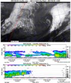 |
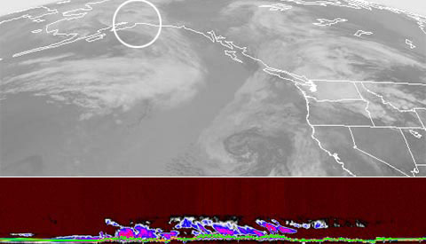
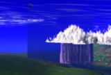
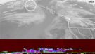
cloudsat pass.j pg
into the lower
panel) is output in color and shows a vertical cloud profile far
more complex than the two-dimensional GMS-6 imagery would suggest.
This image may be downloaded from:
1052 x
900 | 734.40kB
source page
|
 |
133656main clou dsat-calipso-bro
wse.jpg
NASA's CloudSat and CALIPSO (Cloud-Aerosol Lidar and
Infrared Pathfinder Satellite Observations) launch from Vandenberg
Air Force Base, Calif., was scrubbed Tuesday shortly before 6 a.m.
EDT
540 x 800 | 89.60kB
source page
|
 |
cloudsat 3D clo uds.jpg
energy in
the atmosphere. See animation of this data simulation at
www.nasa.gov/mi ssion_pages/cali pso/multimedia/c loud_calip_mm.ht
ml. Note to editors: This image may be downloaded at
675 x 1000 | 368.50kB
source page
|
 |
cloudsat.jpg
CloudSat orbiting, radar operates 2
June 06, see CloudSat home page , /or use links at left here for
orbit overpass info
842 x 595 |
61.40kB
source page
|
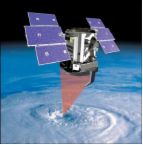
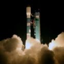 |
147729main clou dsat-launch-2006
0428-20.jpg
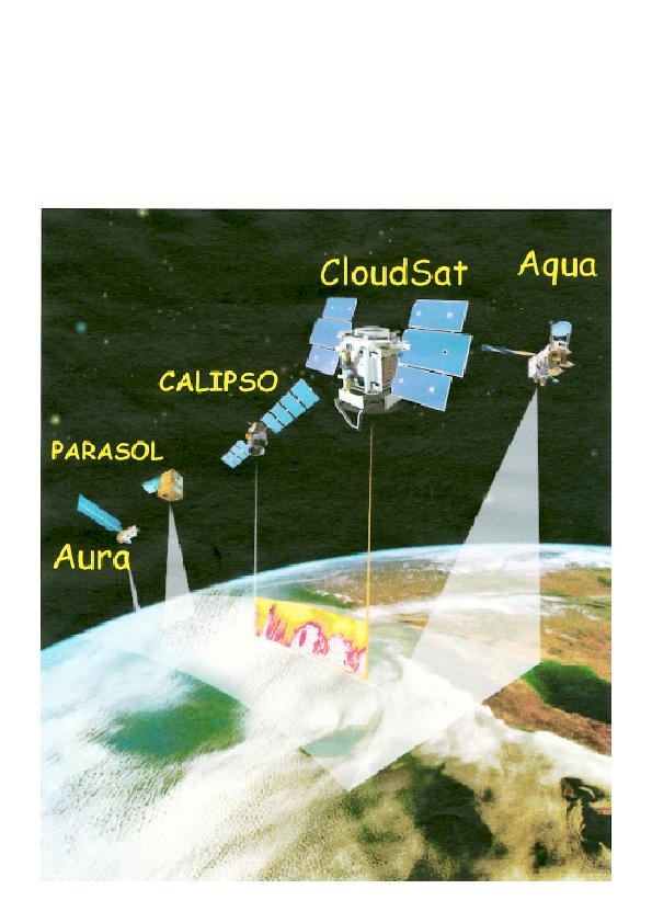
polar orbit, which means they will always cross
the equator at the same local time. Their technologies will enable
scientists to study how clouds and aerosols form, evolve and
interact. Image right: CloudSat/Calips o launch. Image credit:
Boeing/Thom Baur + Full image and caption
200
x 200 | 4.90kB
source page
|
 |
174903main Clou dsatSeeThrough.j
pg
climate. A team of researchers recently completed a
project to confirm what NASA satellites are telling us about how
changes in clouds can affect climate in the coldest regions on
Earth. Image right: NASA's CloudSat spacecraft peered into wintry
skies during the 2007 Canadian field campaign to observe cloud
particles and determine the mass of water and ice within clouds.
To
200 x 300 | 12.20kB
source page
|
 |
200667203615108 060607cloudsat.j
pg
Vane, a CloudSat investigator. We're no longer looking at
clouds like images on a flat piece of paper but instead we're
peering into the clouds and seeing their layered complexity.
Aviation Week reports that Russian's space agency, Roskosmos plans
an ambitious LunarGlob mission in 2012 - funding permitting -
featuring 12 penetrator probes fired into the lunar surface
218 x 380 | 19.10kB
source page
|
 |
cloudsat.jpg
EROS-B Izrael Svobodnyj Start 1
2006-015A 29092 26.04.2006 YW-1 na Taiyuan CZ 4B 2006-016A 29107
28.04.2006 CloudSat USA Vandenberg Delta 7420 2006-016B 29108
28.04.2006 CALIPSO USA Vandenberg Delta 7420 2006-017A 29111
03.05.
284 x 394 | 23.10kB
source page
|
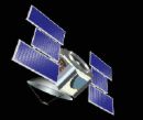 |
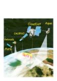
109202main clou dsat.jpg
Within
the first 30 days of the launch, CloudSat will be maneuvered into
formation to maintain a precise distance and time separation from
CALIPSO creating a virtual spacecraft platform. The CloudSat Mission
is a partnership between Colorado State Univerity , the Jet
Propulsion Laboratory in California, the Canadian Space Agency , the
U.S. Air Force and the U.S. Department
252 x
300 | 15.50kB
source page
|
 |
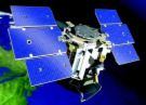
126653main clou dsat-globe2-330.
jpg
is 22 months to enable more than one seasonal cycle to be
observed, although the radar lifetime is expected to approach three
years. CALIPSO is planned for three years of on-orbit operation.
Image above: Artist's concept of CloudSat. Image credit: NASA/JPL.+
Larger image
223 x 330 | 13.60kB
source page
|
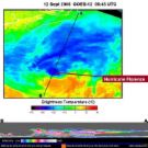 |
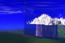
157759main1 Flo renceCloudsat sm
.jpg
The CloudSat and the GOES Satellites Look at Florence
Click image to enlarge These two images satellite images in the same
frame are from two different satellites, giving a top-down and
sideways view of Florence when she was a hurricane on Sept
350 x 350 | 36.50kB
source page
|
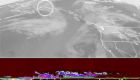 |
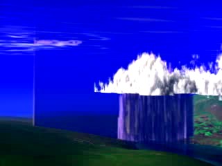
060806 cloudsat .jpg
provided
breathtaking new views of the weather on our planet, said Graeme
Stephens, CloudSat principal investigator and a professor at
Colorado State University. Image taken by Cloudsat of storm over
central Alaska. The first images from NASA's new CloudSat satellite
are already revealing never-before-se en 3-D details about
275 x 480 | 25.50kB
source page
|
From Yahoo Image Search:
'CloudSAT'
Tue Apr 22 12:18:59 2008
|